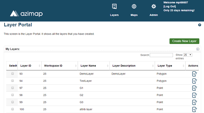
This is the Layer Portal. You can access it at any time by clicking Layers on the site header. All layers in your current workspace will be displayed here.
AziMap gives you the option of exporting any layers you have created as ShapeFiles. To begin select the checkbox next to the layer you want to export.
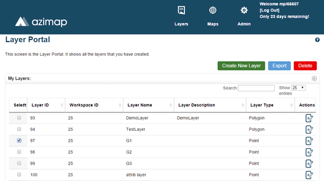
With one layer checked, the Export Button will appear.

Click it to open the Export Layer Panel.
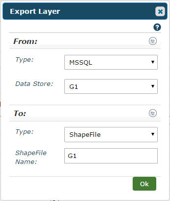
In the From section:-
Type - Select the type of layer you're exporting.
Data Store - This dropdown contains all your layers. You can choose a different one to export from here if you'd like.
In the To section:-
Type - Select an output type for your exported layer. Currently the only available choice is ShapeFile.
ShapeFille Name - The name of your layer will be entered automatically. You can change this to whatever name you want to give the exported ShapeFile.
Click OK when you're ready and a download link will appear.
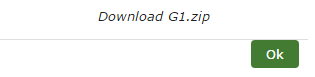
Click the link and your ShapeFile will be downloaded in a zipped folder.
Note: If you want to export a layer you created yourself, see the AziMap Tools section for details on adding features to it first. A layer with no features will produce a blank ShapeFile.